Search the site
Quick Contact
Email: ernie.clark@wiltshire.gov.ukMobile: 0794 120 1995


News articles from around the Division:
Saturday January 16, 2010
A partial solution to Devizes Road lorries?
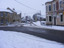
It will take time, but might be the answer.
Devizes Road residents are getting a lot of unnecessary traffic due to GPS navigation systems not having the latest data. There is now a high tech solution to this but it may require a little organizing.Googlemaps, TeleAtlas and Tom Tom are now partnering together to get the best possible mapping data. As such they are also giving the public the opportunity to input road changes and updates.Teleatlas is now having a utility for the public to report road changes called “Map index”. Click here and select “report Map changes”. You are then prompted to input the road change you find important to report. If people put in their e-mail address they will also be posted on the progress.The thing is, of course, for them to be sure that the data input is reliable; they need a certain number of updates on the same point before they will visit to survey and implement it into the data sets. This can take time.The more people that report 'changes' such as the dead-end road at Ashton Road and the 20mph zone and weight limit on Devizes Road correctly and consistently the quicker it will go in.If you haven't submitted a report yet, please do so.